
Greenland Ice Sheet

It is fluctuating between minus 42 and 52 degrees Celsius. Not too bad perhaps for those used to these temperatures but for us originating out of the warm sub-tropics, it was COLD.
We are in Kangerlussuaq in February, a strange little town, lacking any of Greenland’s cultural signatures. It is essentially a renovated US Military Air Force Base which once went by the name of Bluie West Eight. Military personnel had been stationed here in rolling calls of duty since 1941, serving throughout World War 2, the Korean War, and the Cold War. It continued as a training base and refueling stop for polar flights between Europe and North America back in the day when it was a double-hop journey. The base eventually became inactive and was sold back to the Greenland Government for the princely sum of $1.

Most of the township’s permanent buildings are renovated military structures. The abandoned airfield was perfect for a much needed centralized international airport. There are a couple of shops (closed when we were there) and a supermarket. Dining and any socializing is done in the terminal building. Population is around 500. We stayed in the old barracks about one hundred metres from the terminal; basic, but clean and warm. The novelty of the situation overrided any lacks. The only charm of Kangerlussuaq township is in it’s unusual persona.
But Kangerlussuaq has another attraction in that is it has the only practicable access to the Greenland Ice Sheet, which was why we were here freezing our butts off before our dash back to Denmark.

And so on this particular morning, just after first light, we were waiting for the 4×4 trucks that were to take us to Point 660, the edge of the Ice Cap. The truck was late! Not just a little bit! A good half hour or more. Within ten paces of stepping outside our room the icicles had built up on clothing, hair and eyelashes. You could actually hear the follicles crackling as they froze. There was no warm or sheltered spot to wait, so we stomped around the car park in our triple thermal socks in fur-lined boots, double-gloved fingers dug deep into pockets, trying to keep the circulation going. For you find out very quickly in these temperatures, that the cold is bearable (presuming you are dressed properly), if you keep moving. It is the standing still that gets you and it is where you connect to the ground that it is the coldest.

Whilst hopping from one foot to the other, I spent some time scanning the steep mountain slopes directly beside us in search of musk oxen which were supposedly prevalent in the area. I did catch sight of a couple very high up but they were indistinct against the white backdrop, their coats dusted in snow, and shielded a little behind the scraggly brush they appeared to be nibbling on. Regrettably it was the best I was going to get as we did not see any more during our time there.

Finally the truck arrived and we thankfully piled in. No heating! Metal floor indescribably cold so suspended our feet above the floor as much as was possible. And so we set off along Greenland’s longest road; all of 51 kilometres in length, built of course courtesy of the military, otherwise I daresay it would not exist.
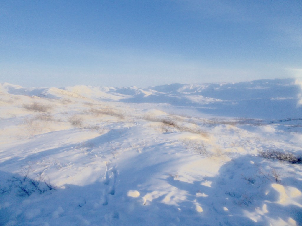
Driving up the valley, the endless white landscape was indescribably beautiful in its purity against the now piercing blue sky. The contours of the land smoothly coated in brilliant white, twinkling silver in the sunlight. The soft hues of blues and greys in the creases and the shadows. The turquoise blues and greens of the ice walls. The muted browns of the bare naked rock. Mountains, rivers, valleys and lakes dressed in their mid-winter garb. Natures perfection.
We stopped, and nursing a warm mug of coffee explored the site of one of three fighter jets that crashed in a 1968 whiteout. Happily the pilots ejected and survived so was able to survey the bits strewn around without regret. There was not much left after all this time, but it was a beautiful spot on a beautiful day so did not care and enjoyed the opportunity of walking around.

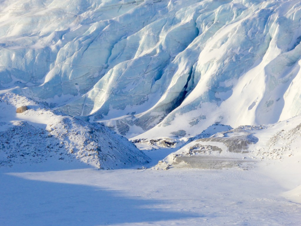
Finally we arrived at the edge of the Ice Sheet. At this point we are 660 metres above sea level, hence the name I suppose. The Ice Sheet covers an area of around 1.4 million square kilometres and is built of layers of ice, snow and debris compacted over thousands of years averaging between 2 and 3 kilometres thick. It is constantly on the move. We made our way to the towering ice cliffs. The translucent blues and greens of the walls were stunningly beautiful and we braved frozen fingers for photos and selfies.

Settling into single file we climbed up onto the cap itself keeping to the track created by the guide. Footing was perilous due to the uneven surface created by the endlessly moving ice. We picked our way carefully up the ridge, clambering over jagged boulders coated in lethally slippery, iron-hard ice. We had not been provided with crampons or ice picks so it was a relatively slow and difficult trek. Each step was taken with care; several people had nasty falls. (Tourism Greenland has much to learn about health and safety!) But we got there in one piece and the rewards were great.

Stretching endlessly in three directions, the ice panorama across the glacial foothills was breathtaking. We looked in awe across the rolling sheets of ice, constantly moving, constantly changing. I was so aware of the privilege of being in such a place at such a time and being able to absorb and experience and breathe in this spectacle of raw beauty. I could have stayed there forever just drinking it in. But of course I could not. It was too cold.
